Mount Sabyinyo Hike in Uganda
When planning a Mount Sabyinyo hike, prepare for an experience very different from an ordinary forest walk or savannah safari. Starting inside Mgahinga Gorilla National Park, the trail climbs through bamboo forest and volcanic ridges to a unique tri-border summit. Also written as Sabinyo, this peak is a highlight for adventure seekers in southwestern Uganda who want to experience standing in three countries at once. However, its steep slopes, vertical wooden ladders, and rapidly changing weather make it a serious physical undertaking rather than a casual nature walk. Orugano Safaris manages all logistics for this trek, including private transport, park permits, ranger guides, and local accommodation.
Table of Contents
- Mount Sabyinyo at a Glance
- Why Choose the Mount Sabyinyo Hike?
- What the Hike is Really Like
- How Difficult is Mount Sabyinyo?
- Who Should, and Should Not, Climb?
- What to Pack for the Climb
- Porters and Guides
- Best Time to Climb
- Mgahinga Volcano Comparison
- Where to Stay
- Suggested Itineraries
- Costs and Inclusions
- Frequently Asked Questions
- Plan Your Mount Sabyinyo Hike
Mount Sabyinyo at a Glance
| Detail | Information |
|---|---|
| Location | Mgahinga Gorilla National Park, southwestern Uganda |
| Starting Point | Ntebeko Visitor Centre |
| Highest Summit | Approximately 3,669 metres |
| Typical Duration | Full-day climb |
| Relative Difficulty | Challenging |
| Approximate Ascent | 1,200–1,300 metres |
| Distinctive Feature | Wooden ladders and three-country summit |
| Management | Uganda Wildlife Authority |
| Guide | UWA ranger guide mandatory |
| Best Suited To | Fit hikers comfortable with heights |
The official Rwanda tourism page describes Sabyinyo as the oldest Virunga volcano and explains the “old man’s teeth” name, although its six-hour Rwanda route only reaches Peak 1 and must not be confused with Uganda’s longer Peak 3 route. Visit Rwanda's Sabyinyo information.
Why Choose the Mount Sabyinyo Hike?
Mount Sabyinyo offers a distinctive physical challenge compared to its neighbours, Gahinga and Muhabura.
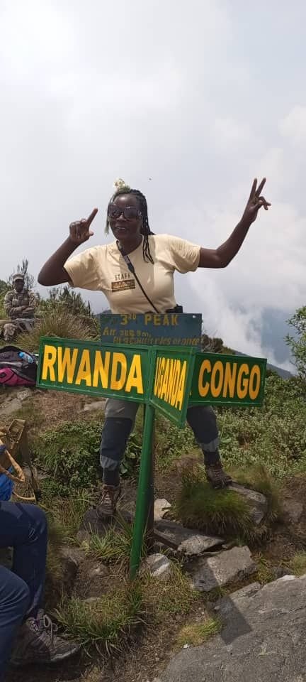
- The Triple-Border Summit: The ultimate goal of the Sabyinyo climbing route is to stand at the point where the borders of Uganda, Rwanda and the Democratic Republic of the Congo meet.
- The Famous Ladders: The upper ridges are so steep that UWA has installed a series of wooden ladders to allow access. During my July 2026 climb, repair work was underway on sections of the ladder route. Although these improvements may make some sections easier to negotiate, Sabyinyo remains a demanding climb.
- Vegetation Zones: You move through four distinct zones: bamboo forest, Hagenia-Hypericum forest, sub-alpine, and alpine moorland.
- A Quieter Challenge: While gorilla trekking in Bwindi draws the crowds, the Sabyinyo trail offers a quieter mountain experience than Uganda’s better-known wildlife activities.
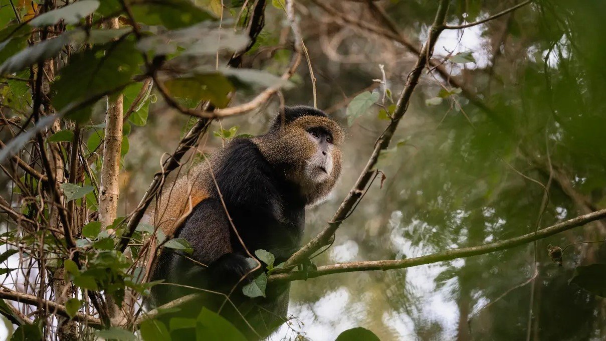
- Wildlife Potential: While not guaranteed, the lower slopes are home to golden monkeys, forest elephants, and endemic birds like the Rwenzori Turaco.
What the Hike is Really Like
Members of our guiding team have climbed Sabyinyo several times, and I completed the climb personally in July 2026. I found the experience tougher and longer than I expected. Tough as it was, I made it to the first peak, while our guides regularly complete the full route. Based on that climb and our operational experience in the region, the route is best understood in five stages.
1. Registration and Briefing at Ntebeko
Hikers normally report to Ntebeko early in the morning for registration and briefing. On my July 2026 climb, we were required to report by 7:30 AM, but exact times should be reconfirmed before your climb. After checking your permits and passport, a UWA ranger provides a briefing on trail conditions and safety. This is where you meet your porters, and hiring one is highly recommended to keep your hands free for the ladders.
2. The Forest and Bamboo Zone
The first two hours are a relatively gentle incline through the forest. After heavy rain, sections of the forest and bamboo zone can become deeply muddy and considerably slower to negotiate. This section is excellent for birding, but the thick bamboo canopy means visibility of the peaks is limited until you gain more altitude.
3. The Steep Ridges and Wooden Ladders
Once you clear the forest, the terrain changes into sharp, narrow volcanic ridges. This is where Sabyinyo earns its name ("Old Man's Teeth" in the local language, referring to the jagged peaks). You will encounter numerous wooden ladders. Some are near-vertical and require intense focus. They form part of the established UWA route, but must be used cautiously; wet conditions make the wood more slippery and progress is usually slower.
4. Reaching the Three-Country Summit
There are three main peaks. Peak 1 stands at 3,428 metres and Peak 2 at 3,537 metres. Reaching Peak 3, the true summit at 3,669 metres, requires descending into deep saddles and climbing back up steeper ladder sections. On a clear day, the views across the Virunga volcanoes and into the Congo are unmatched. If it’s cloudy, you may find yourself standing in a white-out at the border post. On our July 2026 climb, the ranger advised that hikers needed to reach Peak 3 by approximately 1:00 PM to allow sufficient time to descend before dark. The ranger may apply an earlier turnaround time depending on weather, trail conditions and group pace.
5. The Descent: The Hardest Part
The complete ascent and descent commonly takes around eight hours, but weather, trail conditions and group pace can make the day considerably longer. For many hikers, the descent is the most demanding part of the day because it requires intense concentration on the ladders after several hours of physical exertion. The mud in the bamboo zone is even more slippery on the way down, and the repeated drops and climbs between the peaks add to the strain.
How Difficult is Mount Sabyinyo?
Hiking Mount Sabyinyo in Uganda is not a technical mountaineering expedition, but describing it as an ordinary day hike is misleading. It is one of Mgahinga’s most demanding one-day climbs. While Mount Muhabura involves a longer continuous ascent, Sabyinyo presents a more technical-feeling challenge due to its ladders, ridges, and repeated descents between peaks. You need substantial cardiovascular endurance for an ascent of approximately 1,200–1,300 metres, followed by a long and demanding descent.
If you have a severe fear of heights, this is not the hike for you. Some ladder sections sit right on the edge of steep drop-offs. If you want a volcanic experience without the ladders, we suggest choosing Mount Gahinga instead.
Who Should, and Should Not, Climb?
This hike is suitable for:
- Regular hikers and gym-goers with good leg strength.
- Travellers who want the unusual experience of reaching the three-country summit.
- Adventure seekers comfortable with ladders, steep ridges and exposed terrain.
- Fit gorilla-trekking travellers wanting a harder challenge.
This hike is a poor choice for:
- Travellers with chronic knee or hip problems.
- Anyone with a serious fear of exposed heights.
- Hikers without proper, high-traction footwear.
- Beginners who have never completed an 8-hour mountain trek before.
What to Pack for the Climb
The weather at 3,600 metres is unpredictable. It can be 25°C at the base and 5°C with driving rain at the summit.
- Hiking Boots: High-cut with aggressive tread. Do not attempt this in trainers.
- Gloves: Crucial for gripping the wooden ladders, which can be cold, wet, and occasionally splintery.
- Waterproofs: A lightweight rain jacket and trousers are mandatory.
- Gaiters: These prevent mud and stones from entering your boots in the bamboo zone.
- Sun Protection: The sun at high altitude is intense, even through cloud cover.
- Walking Pole: Excellent for the descent, though you'll need to collapse it or hand it to a porter during ladder sections.
We arrange an early packed breakfast, packed lunch and drinking water before departure. Walking poles were available from UWA at the trailhead during my July 2026 climb, but we reconfirm their availability before each trip.
Porters and Guides
A UWA ranger guide is mandatory for safety and navigation. We strongly advise hiring a local porter. Porter charges should be reconfirmed before the climb; approximately US$20 was typical at the time of writing. A porter carries your gear and provides a steady hand on the steep sections, and hiring one is a direct way to support the local community.
Reaching Peak 3 is Not Guaranteed
The ranger may shorten or turn back the climb because of weather, trail conditions, group pace, or safety considerations. The ranger may apply an earlier turnaround time depending on weather, trail conditions and group pace.
My Experience Climbing Sabyinyo
On my July 2026 climb, I was slow but steady. I fell behind with a ranger who was really supportive. I stopped at Peak 1 (3,428m) because I was tired and felt that was as far as I should go.
Even without reaching the three-country summit, Peak 1 felt worthwhile. I spotted the Rwenzori Turaco along the route, and the vegetation was one of the strongest parts of the day. Going with guests also gave me the chance to explain medicinal plants used locally for stomach upsets and fresh cuts. Using a porter for water made a real difference, especially once the climb started to drag.
Best Time to Climb
While you can climb year-round, the dry seasons (December to February and June to August) offer the best chance for clear views and drier ladders. However, "dry season" in a rainforest is relative; afternoon thunderstorms can happen any day. During the wet seasons (March-May and September-November), the mud is much deeper, the ladders are more slippery and progress is usually slower. We recommend an early start regardless of the season to beat the afternoon clouds.
Mgahinga Volcano Comparison
| Mountain | Highest Point | Main Challenge | Best For |
|---|---|---|---|
| Mount Gahinga | About 3,474 m | Forest and bamboo ascent | A less exposed Virunga climb |
| Mount Sabyinyo | About 3,669 m | Ladders, ridges and multiple peaks | Adventure hikers comfortable with heights |
| Mount Muhabura | About 4,127 m | Long, sustained ascent and altitude | Very fit hikers seeking the highest Mgahinga summit |
Where to Stay
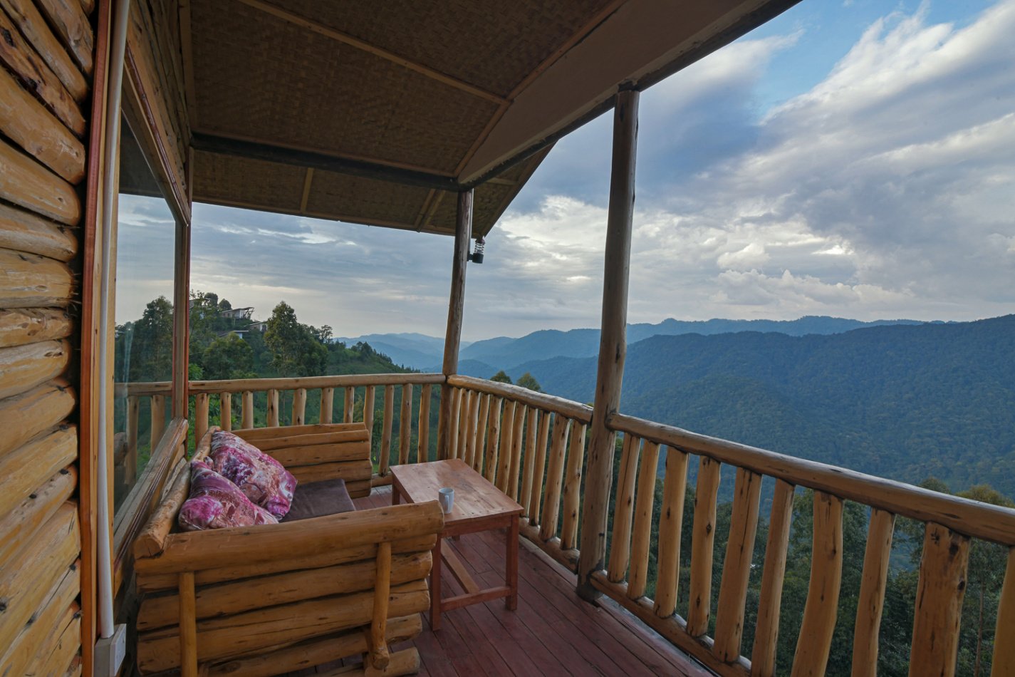
Most hikers stay in Kisoro town or at lodges directly bordering Mgahinga.
You can also stay at our own Orugano Bwindi Lodge in the Nkuringo sector of Bwindi. While the lodge is roughly 1.5 to 2 hours away from the Sabyinyo trailhead, many of our guests choose this to combine the climb with gorilla trekking in Bwindi. We arrange an early 5:00 AM transfer and provide an early packed breakfast for these sessions.
Suggested Itineraries
- 2-Day Peak Challenge: Arrive in Kisoro/Mgahinga on Day 1; full-day Sabyinyo climb on Day 2.
- 3-Day Primate & Peak: Day 1: Arrive; Day 2: golden monkey tracking; Day 3: Sabyinyo climb.
- 5-Day Adventure: Day 1: Arrive Bwindi; Day 2: Gorilla Trekking; Day 3: Transfer to Mgahinga/Lake Mutanda; Day 4: Sabyinyo Climb; Day 5: Departure.
Costs and Inclusions
The total cost depends on the UWA volcano-climbing charge, applicable park entry, optional porter support, transport, meals and any accommodation required. As of July 2026, the UWA climbing charge was US$100 for foreign non-residents, while porter support was approximately US$20. Confirm the current charges before booking because official tariffs can change. Complete package quotations vary by group size and starting location.
At Orugano Safaris, your booking fees normally include:
- UWA ranger fees and park entry
- Private 4×4 ground transfers
- Early packed breakfast
- Chef-prepared packed lunch, plenty of drinking water, and fruit juice or an energy drink
- Orugano guide support
Walking poles were available from UWA at the trailhead during my July 2026 climb, but we reconfirm their availability before each trip.
Request current Sabyinyo hiking cost and availability
Frequently Asked Questions
How long does the Mount Sabyinyo hike take? Most hikers take between 8 and 10 hours. If you are very fit, it can be done in 7, but plan for a full day.
Are the ladders safe? The ladders form part of the established UWA-guided route, but hikers must use them cautiously. Wet conditions make the wood more slippery, and you should follow your ranger’s instructions at all times.
Can a beginner climb Sabyinyo? Only if the beginner is physically fit and has no fear of heights. It is not an entry-level "hill walk."
Is Mount Sabyinyo in Uganda or Rwanda? The mountain is shared by Uganda, Rwanda, and the Democratic Republic of the Congo. However, the most established "ladder route" to the summit is accessed from the Ugandan side in Mgahinga National Park.
Can I combine Sabyinyo with gorilla trekking? Yes, but not on the same day. Both activities are full-day physical challenges. We recommend doing the gorillas first, followed by a rest day or a lighter activity like golden monkey tracking, then the Sabyinyo climb.
Plan Your Mount Sabyinyo Hike
Tell us your preferred dates and how many people are in your group. Please also mention your current hiking experience so we can advise if Sabyinyo is the right choice for your fitness level.